Section by Section Guide
The Section by Section guide is designed to help you decide which part of the Track you’d like to walk and to give you all the planning information you need including: how to get there, highlights, interesting places, weather forecasts, Track conditions, the Track Towns and photos.
The nine sections are from town to town.
-
The Darling Range
Kalamunda to Dwellingup
1 -
Dwellingup
Dwellingup to Collie
2 -
Collie
Collie to Balingup
3 -
Balingup
Balingup to Donnelly River Village
4 -
Donnelly River
Donnelly River Village to Pemberton
5 -
Pemberton
Pemberton to Northcliffe
6 -
Northcliffe
Northcliffe to Walpole
7 -
Walpole
Walpole to Denmark
8 -
Denmark / Albany
Denmark to Albany
9
Kalamunda
Located in the Perth hills, Kalamunda is the starting point for walkers heading south. The town has the feel of an English village and along with a great range of cafes, restaurants and pubs you’ll find boutiques and galleries to browse. A great place to spend a night before heading off on the Track or […]
More InformationMundaring
The Bibbulmun Track crosses the Mundaring Weir Wall. The Track does not pass through the village of Mundaring but does cross its most popular feature, the Mundaring Weir, 7km from the centre of the village. Mundaring is a vibrant cultural community and a haven for nature-based activities, especially walking and cycling. The pristine beauty of […]
More InformationDwellingup
Only one and a half hours from Perth, Dwellingup is a popular destination for weekends and day trips. Surrounded by forest and with the Murray River close by, the town offers a number of attractions including delightful orchards, an old fashioned pub (with an interesting history), an award winning cidery, adventure activities, equipment hire and […]
More InformationCollie
{media-1}The Track links to Collie via a 2.7km spur trail. Collie is large enough to offer all the services expected of a regional centre, but small enough to retain its country charm and hospitality – it is a warm and friendly community surrounded by forests, rivers and lakes. The Collie Visitor Centre is a welcome […]
More InformationBalingup
{media-1}Balingup is a popular destination for our Bibbulmun Walking Break packages as, in addition to lovely scenery, the town offers an interesting variety of shops and some fabulous places to eat. Balingup is famous for its wonderful scenery. Rolling green hills are shrouded with mist in the winter and spring brings acres of beautiful blossoms. […]
More InformationDonnelly River Village
{media-1}The half-way point of the Track is the historic mill town of Donnelly River Village (DRV) nestled in the valley of the river from which it was named. DRV is now a holiday village famed for its tame wildlife and tranquil forest setting. The village takes you back to the 1950s with an original steam […]
More InformationPemberton
{media-1}Pemberton is situated in a valley, surrounded by the karri forests of the Gloucester National Park and the Pemberton Forest Park. It is a pretty timber town, which enjoys a cool climate and has a good variety of attractions, so it’s worth planning to stay an extra day or two. When you reach the friendly […]
More InformationNorthcliffe
Located 360km south of Perth, Northcliffe has the unique distinction of being the only town founded in WA specifically for the First World War Group Settlement Scheme. There is an old fashioned country, community spirit that is still alive in Northcliffe, which has existed since the early settlement days. {media-1}This country hospitality extends to the […]
More InformationWalpole
Located an hour and a half’s drive from Albany in the east and Pemberton in the west, Walpole is an ideal place to base yourself to explore the region and for walking on the Bibbulmun Track. The tiny town, which has a population of about 500, is located in a rather picturesque region of Western […]
More InformationPeaceful Bay
{media-1}Peaceful Bay is a picturesque holiday spot on the edge of the Southern Ocean. While it’s a bit of stretch to call Peaceful Bay a Track Town as it’s such a small community, we’ve included it in this section as it does offer accommodation and some services for walkers. The bay is ideal for swimming, […]
More InformationDenmark
Denmark is a popular tourist town which has a relaxed village atmosphere, romantic timber milling history and incredible coastal scenery. Just 45 minutes drive west of Albany on the southern coast, Denmark stands on the shores of the spectacular Wilson Inlet and boasts glorious swimming, surfing and fishing beaches. There’s plenty of attractions in town […]
More InformationAlbany
{media-1}The City of Albany is set on the rugged south coast of Western Australia and is the southern terminus of the Bibbulmun Track. Albany has one of the most beautiful natural harbours in the world and a dramatic convict history. Step back in time and explore convict jails, old taverns, whaling ships and settlers’cottages and […]
More InformationMt Cooke pine plantation
Fern Rd
Asher Rd
Paulls Valley Rd
South Ledge
Mundaring Weir Rd (south end wall)
Mundaring Weir picnic area (north end wall)
Mundaring Weir Hotel
Perth Hills Discovery Centre
Dale Rd picnic area
Brookton Highway
Kinsella Rd
Sullivan Rock
Cowcher Rd
Coach Rd
Wearne Rd
North Bannister Roadhouse
Albany Highway
Ingelhope Rail Crossing
Nanga Rd
River Rd
Yarragil Form
Driver Rd
Harvey-Quindanning Rd
Harris River Rd (Harris Dam picnic area)
Mornington Rd
Allanson Rd
Coalfields Highway
Mungalup Rd Bridge (Collie River)
Mungalup Rd (south)
Mungalup/South Rd (Wellington Spur Trail)
Wight’s Rd (Wellington Spur Trail)
Wellington Dam (Wellington Spur Trail)
Glen Mervyn Dam (Collie-Preston Rd)
Mumballup Forest Tavern (Donnybrook-Boyup Brook Rd)
Lowden-Grimwade Rd
Tower Rd
Kirup-Grimwade Rd
Balingup-Grimwade Rd
Jayes Rd
Golden Valley Tree Park
Hay Rd
Spring Gully Rd (east)
Spring Gully Rd (west)
Southampton Rd
Southampton Bridge
Karri Gully (Brockman Highway)
Brockman Highway (west)
Willow Springs
Donnelly River Village
Shoe Rd/Tom Rd intersection
Mack Rd
Green’s Island (recreation site)
Graphite Rd (One Tree Bridge)
Chappels Bridge
Palings Rd
Seven Day Rd
Beedelup Rd (Karri Forest Explorer Drive)
Beedelup Falls
Channybearup Rd
Stirling Rd
Big Brook Dam
Gloucester Tree
Cascades Spur Trail
Gloucester Rd
River Rd Bridge
Wheatley Coast Rd
Hill Brook Rd
Karri Hill Rd
Lane-Poole Rd
Middleton Rd
Muirillup Rd
Windy Harbour Rd
Chesapeake Rd (west)
Chesapeake Rd (east)
Deeside Coast Rd
Dog Rd
Pingerup Rd
Mt Chance spur (South Western Highway)
Mt Pingerup trail
Broke Inlet Rd
Mandalay Beach Rd
Shedley Drive/Deep River Bridge
Tinglewood Rd
John Rate lookout
Isle Rd
Rest Point Rd
Coalmine Beach (Knoll Drive)
South Coast Highway (west)
Hill Top Lookout
Giant Tingle Tree (Gully Rd)
Sappers Bridge
Tree Top Walk
South Coast Highway (east)
Ficifolia Rd
Conspicuous Beach carpark
Peaceful Bay Rd (north)
Parry Beach Rd
Parry Beach Camping Area
William Bay Rd
Lights Beach carpark
Lights Rd
Ocean Beach Rd
Maraveen Place
Inlet Drive
Denmark Rivermouth
Eden Rd gate
Tennessee Rd South (Lowlands Beach)
Shelley Beach Rd
Cosy Corner picnic area
Mutton Bird Rd carpark
Mutton Bird Rd
Sandpatch carpark
Frenchman Bay Rd
Pinjarra-Williams Rd (Nyingarn Bidi Loop)
Pinjarra-Williams Rd (Nyingarn Bidi Loop)
Lease Rd
Nullaki Boat Ramp
Boxall Rd
The Gap track
Kingie Rock carpark
Groper Bay
Boat Harbour Rd
Shepherds Lagoon Rd
Arcadia Group Campsite
Capacity: 17 
Lyall’s Mill Group Campsite
Capacity: 17 
Hewett’s Hill Campsite
Capacity: 12 
Ball Creek Campsite
Capacity: 8
Helena Campsite
Capacity: 20-24
Waalegh Campsite
Capacity: 12
Beraking Campsite
Capacity: 12-15 
Mt Dale Campsite
Capacity: 12
Brookton Campsite
Capacity: 12-15
Canning Campsite
Capacity: 12-15 
Monadnocks Campsite
Capacity: 12-15
Alyi-wa Miya Group Campsite
Capacity: Tent sites only. No sleeping shelter.
Mt Cooke Group Campsite
Capacity: Tent sites only. No sleeping shelter. 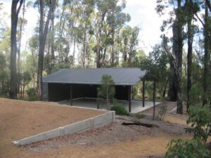
Mt Cooke Campsite
Capacity: 12-15 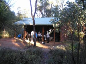
Nerang Campsite
Capacity: 12-15
Gringer Creek Campsite
Capacity: 12-15
White Horse Hills Campsite
Capacity: 12-15
Mt Wells Campsite
Capacity: 8
Chadoora Campsite
Capacity: 12-15 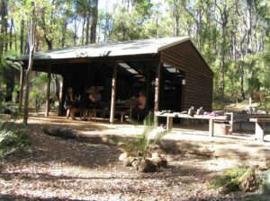
Swamp Oak Campsite
Capacity: 12-15 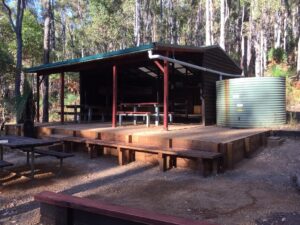
Murray Campsite
Capacity: 12-15 
Dookanelly Campsite
Capacity: 12-15 
Possum Springs Campsite
Capacity: 12-15 
Yourdamung Campsite
Capacity: 12 | No Fire Campsite 
Harris Dam Campsite
Capacity: 12 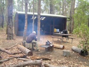
Yabberup Campsite
Capacity: 12 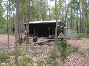
Noggerup Campsite
Capacity: 12 
Grimwade Campsite
Capacity: 12 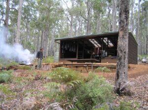
Blackwood Campsite
Capacity: 15 | No Fire Campsite 
Gregory Brook Campsite
Capacity: 12 
Tom Road Campsite
Capacity: 12-15 
Boarding House Campsite
Capacity: 12 
Beavis Campsite
Capacity: 12-15 
Beedelup Campsite
Capacity: 12-15 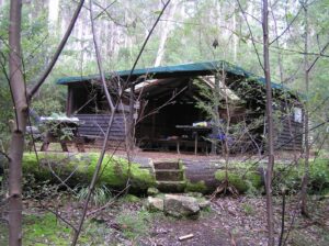
Warren Campsite
Capacity: 12-15 
Schafer Campsite
Capacity: 12-15 
Gardner Campsite
Capacity: 12-15 
Lake Maringup Campsite
Capacity: 12-15 
Dog Pool Campsite
Capacity: 12-15 
Mt Chance Campsite
Capacity: 12-15 | No Fire Campsite 
Woolbales Campsite
Capacity: 12-15 | No Fire Campsite 
Long Point Campsite
Capacity: 12-15 | No Fire Campsite 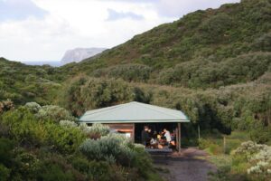
Mt Clare Campsite
Capacity: 12-15 | No Fire Campsite 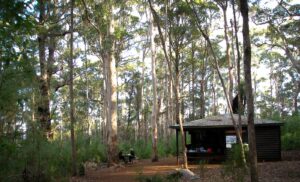
Frankland River Campsite
Capacity: 12-15 | No Fire Campsite 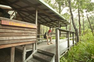
Giants Campsite
Capacity: 12-15 | No Fire Campsite 
Rame Head Campsite
Capacity: 12-15 | No Fire Campsite 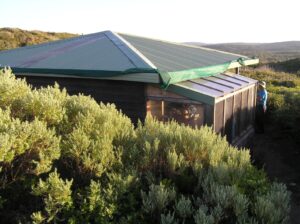
Boat Harbour Campsite
Capacity: 12-15 | No Fire Campsite 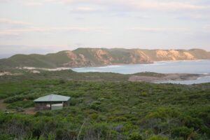
William Bay Campsite
Capacity: 12-15 | No Fire Campsite 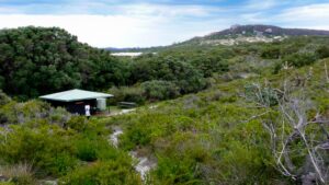
Nullaki Campsite
Capacity: 12-15 | No Fire Campsite 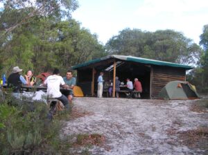
West Cape Howe Campsite
Capacity: 12-15 | No Fire Campsite 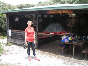
Torbay Campsite
Capacity: 12-15 | No Fire Campsite 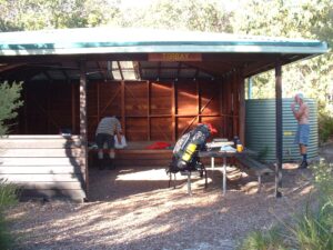
Muttonbird Campsite
Capacity: 12-15 | No Fire Campsite 
Sandpatch Campsite
Capacity: 12-15 | No Fire Campsite 
Denmark townsite spur trail.
The Bibbulmun Track is linked to the Denmark town site by a 1.5km spur trail from the Bibbulmun Track trail head at the Denmark rivermouth.
More InformationPermanent realignment
The Bibbulmun Track has been permanently realigned for 1.5km due to a new road interchange at Princess Royal Drive and Frenchman Bay Road.
More InformationLane-Pool Reserve / Murray River
The Bibbulmun Track has been permanently realigned between Dookanelly and Possum Springs campsites. The realignment is 18.3km and replaces a 18.2km section of track. Download the map. For more information, please contact the Parks and Wildlife Service Mundaring office on (08) 9290 6100.
More InformationGlen Mervyn Dam
The Bibbulmun Track has been permanently realigned for 1.4km west away from the edge of the Glen Mervyn Dam. This has taken place to take walkers away from unsightly waste near the old alignment.
More InformationWellington Dam Spur Trail
The 19km Wellington Dam spur trail links the Bibbulmun Track from near Yabberup campsite, just south of Collie, to the Wellington Dam recreation area in the Wellington National Park. The spur trail was identified as an ideal project to develop due to its proximity to the Perth population base, handy vehicle access and easy […]
More InformationAlyi-wa Miya group campsite spur trail
The new Alyi-wa Miya group campsite in the Monadnocks Conservation Park is now open to hikers, catering for groups of up to 30.
More InformationAlbany Highway realignment
A minor realignment of 280m means that walkers no longer need to walk along the highway.
More InformationNyingarn Bidi Loop
The Nyingarn Bidi trail links Chadoora Campsite with Swamp Oak Campsite south of Dwellingup making a three-day loop.
More InformationSouthern Terminus relocation
The Bibbulmun Track has been permanently realigned. The new Southern Terminus is located next to the Albany Visitor Centre.
More InformationWilson Inlet Sandbar Alternate Route
An alternate route to cross the Wilson Inlet via the seasonal sandbar.
More InformationMundaring Weir after hours alternate route
The Mundaring Weir wall is usually open until 5pm (4pm in winter) each day at which time the gates are closed. If the gates are closed take the alternative route to the other side of the wall.
More InformationMazzoletti Beach Winter Alternative Route
Due to large swells and high tides, Mazzoletti Beach can be difficult to navigate and may be potentially dangerous in some sections during winter. Walkers should consider using the 19.7km alternate route along Parry Beach Road, South Coast Highway and William Bay Road as indicated on the Bibbulmun Track maps, or avoid this section until […]
More InformationGreens Pool alternative for southbound walkers
Please note this alternative route may not be an option if Mazzoletti Beach is closed. Please check Diversions and other Impacts below. Note: Green’s Pool may be closed – if it is there will be a notice under Diversions and Other Impacts below. Depending on conditions due to high tides and the dune access being […]
More InformationLittle River realignment
The Bibbulmun Track has been permanently realigned for 450m, utilising the new section of the Little River Walk Trail.
More InformationMandalay Beach spur trail
A 300 metre spur trail allows walkers to access a lookout with views over Mandalay Beach and across to Chatham Island.
More InformationNyingarn Bidi Loop
The Nyingarn Bidi trail links Chadoora Campsite with Swamp Oak Campsite south of Dwellingup making a three-day loop.
More InformationBoonerring Hill spur trail
Walkers can take a short spur trail to the summit for outstanding 360° views of the area.
More InformationNorth Bannister spur Trail
The Three-ways roadhouse at North Bannister is linked to the Track via an approx. 1.5km spur
More InformationMt Dale
The Track has been realigned in this area to incorporate the Mt Dale loop walk.
More InformationHelena Campsite
The Bibbulmun Track has been permanently realigned for 640m east of Helena campsite.
More InformationPrescribed Burn Diversion – Northliffe
Northcliffe to Dog Pool Campsite
More InformationCampfire Restrictions in place – Blackwood
Balingup to Donnelly River Village
More InformationCampfire Restrictions in place – Pemberton
Pemberton to Northcliffe
More InformationCampfire Restrictions in place – Donnelly
Donnelly River Village to Pemberton
More InformationCampfire Restrictions in place – Collie
Collie to Balingup
More InformationCampfire Restrictions in place – Dwellingup
South of Dwellilngup
More InformationCampfire Restrictions in place – Darling Range
Kalamunda to Dwellingup
More InformationPrescribed Burn Diversion Lane-Poole
Near Swamp Oak Campsite
More InformationYabberup Campsite Maintenance
South of Collie
More InformationPrescribed burn diversion (Mumballup)
South of Collie (near Glen Mervyn Dam Picnic Site)
More InformationPrescribed burn diversion (White Horse)
White Horse Hills
More InformationMutton Bird Campsite
Near Albany
More InformationMice problem
South of Balingup
More InformationDiversion due to bridge damage
North of Beedelup Campsite
More InformationRealignment William Bay National Park
Between William Bay campsite and Lights Beach, east of Denmark
More InformationSeasonal Diversion
Torbay west of Albany
More InformationNorth Bannister Roadhouse
1km from Gringer Creek campsite
More InformationNew Alyi-wa Miya group campsite open
South of Monadnocks campsite
More InformationTimber harvest diversion
Between Dwellingup and Swamp Oak campsite
More InformationWellington spur access
Wellington Dam
More InformationBlasting near Mt Wells and White Horse Hills campsites
Between White Horse Hills and Chadoora campsites south of the Albany Highway and north of Dwellingup
More InformationIrwin Inlet
The Irwin Inlet is crossed using the canoes provided. The crossing is 150 metres.
More InformationParry Inlet
Parry Inlet is typically closed off to the ocean or flowing slowly across a shallow sand bar. After heavy rains though it can flow fast and become quite deep.
More InformationWilson Inlet
There are a number ways to cross the Wilson Inlet but all walkers will to plan ahead.
More InformationTorbay Inlet
Most of the year this inlet can be crossed easily but it can become a deep channel after heavy rains or after being breached.
More Information